
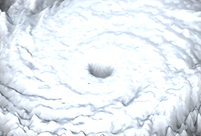
Using National Oceanographic and Atmospheric Administration and the University Corporation for Atmospheric Research data sets, a scaled and interactive stereographic 3D model of Hurricane Katrina was created by parsing approximately 2GB of satellite and radar data. The data includes information such as the planetary boundary layer height, the water vapor mixing ratio at different altitudes, the digital base reflectivity, and the composite reflectivity at three different heights. The data was parsed and converted into a grid of points in three-dimensional space then a surface mesh was generated from the grid points, with shading added to differentiate altitude. The resulting 3D model of Hurricane Katrina was imported into Unity and configured to run in for ICAVE. Users can interact with the model via a game controller or voice commands.
Visualizing Hurricane Katrina